Farmers '˜have nothing to fear' from planned UNESCO Global Geopark


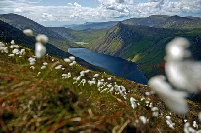
Over the next 18 months Newry, Mourne and Down District Council will be exploring the tourism potential associated with securing UNESCO Global Geopark status in the three Areas of Outstanding Natural Beauty (AONB) within the district.
UNESCO Global Geoparks are single, unified geographical areas where sites and landscapes of international geological significance are managed with a holistic concept of sustainable development, education and protection.
Advertisement
Advertisement
There are currently 140 UNESCO Global Geoparks found in 38 countries around the world, all of which have been developed using a bottom-up approach with local communities playing a significant role in this process.
Those behind the proposal believe it has the potential to make a significant difference to people living in the district of Mourne, Ring of Gullion and Strangford & Lecale.
And they are keen to highlight the fact that a Geopark would have no impact on planning, development or farming practices in the area and only sites with public access already in place will be promoted.
The Ring of Gullion is the most spectacular example of a ring-dyke intrusion in the British Isles. The rocks of the area are complex and have featured in international geological debate over the past 60 or so years.
Advertisement
Advertisement
The site has attracted geologists from all over the world and featured in a number of theories that have been put forward to explain the unusual rock relationships. Some of these theories have now become an accepted part of geological science.
The oldest rocks in the area formed in an ancient ocean more than 400 million years ago during the Silurian period. Masses of molten granitic rock or magma were later intruded into these rocks, which underlie Newry town and much of the Slieve Gullion area. These granites are some 390 million years old and date from a major period of mountain building in Ireland.
In more recent times the landscape has been shaped by the action of glaciers during successive Ice Ages and the Irish word ‘Drumlin’ is now known the world over.
If successful, the UNESCO Global Geopark brand will use the geological heritage of the three areas to develop sustainable tourism that generates economic benefits, while providing recreational opportunities and increased awareness of the area’s natural assets. It will involve people in their landscape and work with local landowners, businesses and communities.
Advertisement
Advertisement
Typical activities in a global geopark include the development of walking and cycling trails, the training of local people to act as guides, provision of information signage and the development of visitor centres. The ultimate aim of a UNESCO Global Geopark is to enhance the economy and develop employment opportunities for the people who live there.
There is a programme of work involved in securing UNESCO Global Geopark status and activity has been initiated to allow a plan to be submitted to UNESCO for consideration by November 2019.
A number of information events have been organised to allow local residents to find out more about the application. The next event will take place on Monday 23 April, from 4pm to 8pm, in Carcullion House, Hilltown.
There will be a community open day on June 2nd at Kilbroney Forest Park, and roadshows at a number of livestock marts including Rathfriland, Hilltown, Camlough and Downpatrick, and at events including Balmoral, Castlewellan and Newry agricultural shows.
Advertisement
Advertisement
This engagement programme presents an opportunity for local residents to meet representatives from the team and to ask questions.
There will also be a series of other engagement events throughout the year to ensure people fully understand the benefits of an association with the UNESCO brand. Highlights include a schools and public roadshow to mark ‘European Geoparks Week’. Please check www.newrymournedown.org for event details.
Dr Kirstin Lemon from the Geological Survey of Northern Ireland (GSNI) explained that the area currently under consideration has many unique qualities which make it an ideal candidate for UNESCO Global Geopark status.
She added: “There are currently three UNESCO designated Geoparks in Ireland, Burren and Cliffs of Moher UNESCO Global Geopark in Co. Clare, Copper Coast UNESCO Global Geopark in Co. Waterford and Marble Arch Caves UNESCO Global Geopark in Co. Fermanagh and Co. Cavan.
Advertisement
Advertisement
“This application will ensure that there is an ongoing emphasis on developing geotourism. Moreover, the underlying ethos of UNESCO Global Geoparks supports the direction of the Newry, Mourne and Down District Council Tourism Strategy 2017-2021, one that explores, develops and identifies the links between the natural heritage (particularly the geological heritage) and all other aspects of the area’s abundant heritage assets.
“Our natural environment and heritage is something that is unique and something we should be marketing.
“Gaining UNESCO Global Geopark status, embracing the importance and natural beauty of the landscapes of Strangford Lough & Lecale, the Mournes and the Ring of Gullion, would help put the area on the map from a tourism perspective.”
Newry, Mourne and Down District Council Chairperson, Councillor Roisin Mulgrew said: “UNESCO Global Geopark status for the area will play a key role in differentiating the region and in giving it a much stronger and cohesive market identity.
Advertisement
Advertisement
“The proposed UNESCO Global Geopark will bring significant economic benefits and will also have an important role to play in empowering local communities, giving them the opportunities to develop cohesive partnerships with the common goal of promoting the area’s significant geological and other heritage.”
Further information on the process is available by logging on to www.unesco.org.