Innovative GPS tracking collars used on grazing sheep to protect Mourne Mountain recovery


The use of GPS trackers on a herd of sheep on Slieve Donard is a first for the National Trust in Northern Ireland. Trackers ‘ping’ an alert if sheep graze land damaged by the fire. Along with drone imagery, habitat monitoring and control sites, the devices will provide valuable data on any impact of grazing and allow the land to be managed for optimal recovery
Back in April 2021 a wildfire in the Mournes destroyed around 200 hectares of National Trust land. One of the worst hit areas was Slieve Donard, Northern Ireland’s highest mountain and a site that’s designated as a Special Area of Conservation due to the montane and dry heath, blanket bog and specialised species which thrive here.
Advertisement
Advertisement
Working with stakeholders Northern Ireland Environment Agency (NIEA) and the Mourne Heritage Trust, the conservation charity has commissioned drone and land surveys to assess the fire damage and monitor the natural regeneration of the heathland. Already there are positives signs of recovery including new heather growth and returning wildlife.
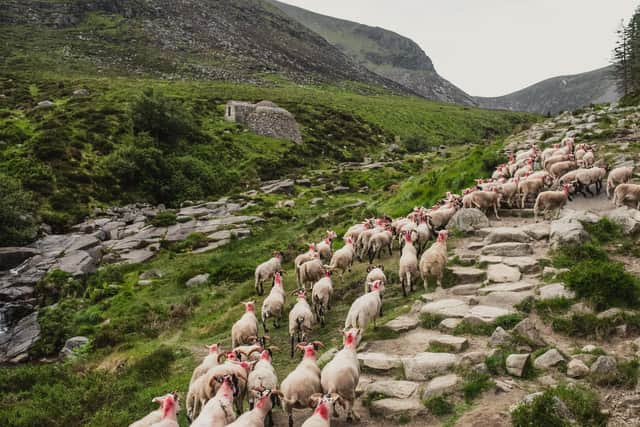
As new shoots begin to emerge the Trust faces a challenge - to ensure the burnt land is given the time and space it needs to recover naturally, while at the same time, continuing to manage the wider landscape for the benefit of nature through the use of conservation grazing.
Rhona Irvine, Rural Surveyor for the National Trust explains: “Light conservation grazing by sheep helps to prevent dominance from individual, more invasive species, as well as reducing the number of woody shrubs. This makes the land more resilient to future fire risk by reducing the potential fuel load. In that way we ensure rare, important and sensitive species are not drowned out and are able to get the light and conditions they need to thrive.”
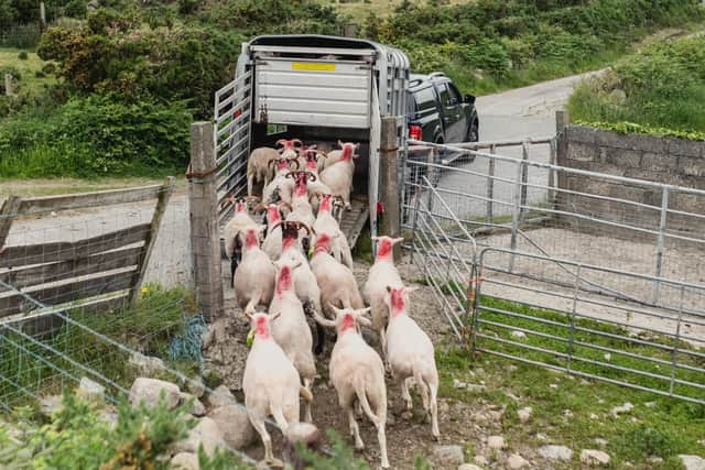
Working with conacre farmer John Maginn, and various advisors the Trust has looked at solutions that would allow conservation grazing on the land to continue, whilst minimising the impact on the burn areas.
Advertisement
Advertisement
“Faced with the problem of how to control the livestock in a landscape which would be impossible to fence or compartmentalise, we came up with an innovative solution,” Rhona continues.
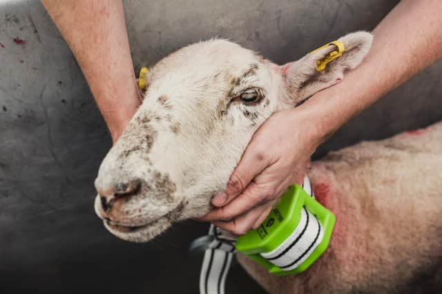
“We are fitting ergonomic GPS tracking collars on a proportion of the flock which will be regularly recording the position of the animals. This information will be relayed back to an app which can be used to assess whether any action needs to be taken to heft the sheep on to different areas of the mountain.”
Farmer John Maginn said: “This new technology is bringing us into the 21st Century. As well as helping us with habitat management, it is enabling a higher level of animal welfare by giving us instant access to information on the individual animals.
“If we do decide that the sheep need to be moved on to a different area, we will resort to the old-fashioned method of using sheepdogs to heft the flock onto new pasture. Our family has been farming in the mountains for many years and it’s great to see money being spent on technology that will make our job easier and more efficient, though we will always continue to rely on the sheepdogs to do what they do best!”
Advertisement
Advertisement
10% of the entire flock have been fitted with the tracking collars and there is the option of additional Bluetooth ear-tags. The collars will track the sheep movements continually, sending a ‘ping’ every 15 minutes, and alerts to the farmer about their activity levels and even their temperature. The sheep will wear the collars until they come back down to lower ground in the autumn.
The collars cost just over £3,000 and are funded by the National Trust’s Farming Innovation Fund. The Trust did the first trials in the world of GPS virtual fencing technology when cattle grazing was re-introduced on the heath at Studland Bay in Dorset and now have a handful of sites using the technology but this is the first National Trust site to use GPS tracking in Northern Ireland.
Data from the trackers will be overlayed with location maps of the sheep to see whether they are spending long periods grazing the new growth as it emerges in the burnt areas.
“Habitat monitoring together with the location data from the trackers will enable our decision making,” adds Rhona. “Along with drone imagery, habitat monitoring and control sites, the devices will provide valuable data on any impact of grazing and allow us to ensure we are making good decisions for the optimal recovery of the land.
Advertisement
Advertisement
“Our aim is to ensure the mountain gets back to full health as soon as possible for the animals and invertebrates that live there, but also for the many people who love, care for and visit this special place.”