Here's the UK weather forecast and latest Met Office warnings with snow to hit in wake of Storm Ciara


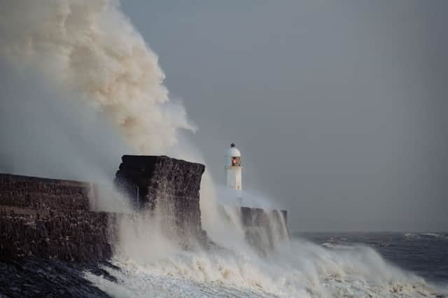
Storm Ciara brought with it flooding and winds of nearly 100mph winds, leading forecasters to dub it the “biggest storm this century”.
The highest wind speed yesterday was recorded at the Needles off the Isle of Wight with gusts of 97mph, the Met Office said.
Advertisement
Advertisement
Helen Roberts, a senior meteorologist with the Met Office, said: “In terms of area this is probably the biggest storm this century. I have not seen amber warnings on this scale, across all of Wales and much of England.


"The yellow wind warnings cover the whole of the UK. This could end up being the biggest storm since 1987.” Wind speeds in the 1987 storm reached up to 100mph.
Transport was thrown into chaos by the gales, rain and flooding. Airlines cancelled and diverted hundreds of domestic and international flights.
British Airways cancelled flights from Heathrow, Gatwick and London City, while Virgin Atlantic also cancelled a number of flights.
Advertisement
Advertisement
Several rail firms across England, Scotland and Wales advised passengers not to travel. Network Rail imposed a blanket speed restriction of 50mph across the network yesterday.


Across the UK yesterday around 118,000 people were at one point left without power. Energy companies said they had reconnected 421,000 customers since the storm hit.
In Perth, Scotland, three people were injured after part of a pub roof collapsed. In East Sussex, a surfer was rescued from rough seas after losing his board following a search by rescue teams from HM Coastguard and the RNLI off Hastings.
Here's what to expect over the next few days:
Are there any more weather warnings?
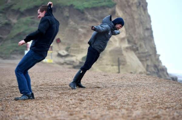
People enjoy leaning into the wind as Storm Ciara arrives in West Bay (Photo by Finnbarr Webster/Getty Images)
Advertisement
Advertisement
Despite the worst of the storm having past, Met Office weather warnings remain in place, particularly in northern parts of the country.
On Monday 10 February, the far south of England is subject to a yellow warning of wind between 10am and 7pm.
The north west of England has a yellow warning for snow and ice from 3pm on Monday afternoon until 11.59pm the next day.
Scotland and Northern Ireland are under a yellow warning for wind and snow from now until 11.59 tomorrow.
Advertisement
Advertisement
On Tuesday 11 February, the yellow warnings for the north west of England, and Northern Ireland and Scotland remain in place.
On Wednesday 12 February, the previous day's warnings' merge, and the north west of England, and Northern Ireland and Scotland see yellow warning for snow and ice.
What's the forecast?
(Photo: Getty Images)
Today
Most areas seeing sunny spells but also blustery showers. Showers heaviest and most frequent in the north and west, with snow over hills, temporary blizzard conditions across the highest routes. Some rain or sleet may cross southern areas. Cold, windy.
Tonight
Windy and cold, with occasional blustery showers. These focused across northern and western areas with rain, hail and snow, several centimetres of snow on northern hills. Icy patches.
Advertisement
Advertisement
Tuesday
Sunny intervals and blustery showers of rain, hail, sleet and snow, even in some southern areas but the worst of the snow for hills further north. Cold, windy and gusty.
Outlook for Wednesday to Friday
Still cold and blustery with wintry showers Wednesday. Cloud and rain with hill snow for parts of England, Wales and southern Scotland Thursday. Further rain Friday, and becoming milder.
This article originally appeared on iNews